
Evaluated by Skiresort.info, the world's largest test portal for ski resorts.
The evaluation is done as follows
Orientation (Trail map, information boards, sign-postings) and safety in the ski resort Zugspitze
Trail map and overview maps
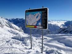
The piste map shows the Garmisch-Classic and Zugspitze ski areas together. The peaks are marked with their altitudes, and more could be added. The slopes and lifts are well represented.
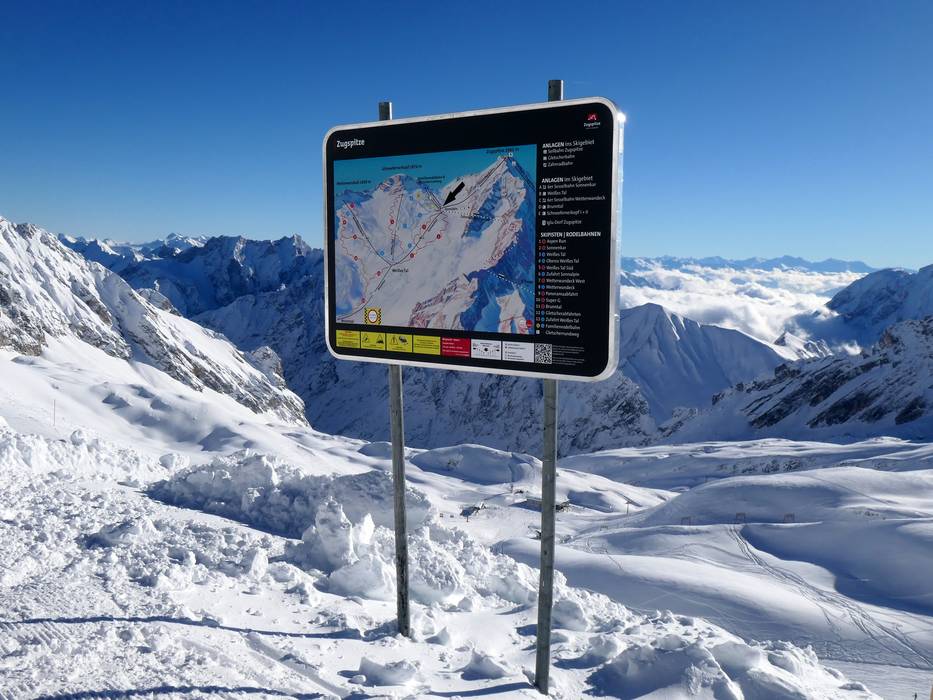
Information boards and sign-postings on the slopes
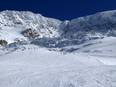
The slopes are numbered and color-coded. Additional markers are placed along the edges for better orientation. For the descent into Brunntal, digital information is provided at the junctions regarding lift openings and possible waiting times. At the mountain station, information on weather, operating and descent times, as well as the avalanche report, is available on info screens.
Trail map

Zugspitze Season 2025/2026

Zugspitze & Garmisch-Classic Season 2025/2026
Top Orientation


9 strengths of this ski resort


Feedback for the Skiresort.info Team? Please use this form

Select specific criteria
Top evaluation criteria
Further evaluation criteria
Orientation (trail map, information boards, sign-postings)
Evaluation criteria for special interests
Feedback for the Skiresort.info Team? Please use this form
Test Reports
Tips for the ski holiday