Bavaria (Bayern): orientation within ski resorts
Ski resorts with the best orientation aids (trail map, information boards, sign-posting) in Bavaria (Bayern)
50 test reports
Best rating:
5 out of 5 stars
Evaluated by Skiresort.info, the world's largest evaluation and test portal for ski resorts.
Click here for rating process info
Ski resorts with the best orientation aids in Bavaria (Bayern)
-
- Bavaria (Bayern) – limit to
Districts: 1. Swabia (Schwaben) , 2. Upper Bavaria (Oberbayern) , 2. Lower Bavaria (Niederbayern) , 4. Upper Franconia (Oberfranken) , 5. Upper Palatinate (Oberpfalz) , 5. Middle Franconia (Mittelfranken)
Greater Regions: 1. Southern Bavaria (Südbayern) , 2. Northern Bavaria (Nordbayern)
Counties/District-Free Cities: 1. Oberallgäu , 2. Garmisch-Partenkirchen , 2. Miesbach , 2. Straubing-Bogen , 2. Freyung-Grafenau , 2. Regen , 2. Bad Tölz-Wolfratshausen , 2. Traunstein , 2. Rosenheim , 10. Bayreuth , 10. Ostallgäu , 12. Deggendorf , 13. Amberg-Sulzbach , 13. Ansbach , 13. Freising , 13. Fürstenfeldbruck
Tourism regions: 1. Eastern Bavaria (Ostbayern) , 2. Franken (Franconia)
Bavaria (Bayern) – switch toMountain ranges: 1. German Alps , 2. Bavarian Forest (Bayerische Wald) , 3. Fichtel Mountains (Fichtelgebirge) , 4. Bavarian Alpine Foreland
Other: 1. Allgäu
The trail map is exemplary. All lifts are indicated with lengths and elevation differences and the... more
The piste map gives a very good overview of the cross-border ski resort. The lifts and slopes are... more
The trail map depicts the entire resort well and other information such as details about the huts... more
The piste map provides a very clear overview of the entire ski resort of Bolsterlang. It shows all... more
The piste map provides a very good description of all lifts and slopes. Contact details, ski... more
The piste map of the ski resort of Spitzingsee-Tegernsee provides a very clear overview of the... more
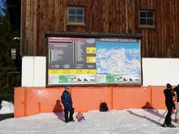
The piste map of the ski resort of Sudelfeld provides a very clear overview of the complete winter... more
The trail map is clear and detailed. The connection slope to the Kißlinger lift could be added as... more
The trail map depicts the Garmisch-Classic ski resort very well. All slopes and lifts are marked... more
The trail map depicts the ski resort well. The slopes, lifts and restaurants are indicated on the... more
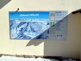
The Proeller ski area has its own trail map, which is clear, detailed and informative. The names of... more
The trail map depicts the ski resort well. All lifts are indicated with lengths and elevation... more
The trail map is very good. All lifts are indicated with lengths and elevation differences and the... more
The trail map is easy to read and includes all information about the ski resort, the toboggan run... more
The trail map depicts the ski resort relatively well. The most important details such as... more
The trail map depicts the Balderschwang ski resort with the Riedberger Horn and the Schelpen very... more
The trail map depicts the Classic and the Zugspitze resorts together as well as the Zugspitze... more
The trail map depicts the entire Ochsenkopf region very well. All ski lifts and slopes in the... more
There is one trail map of the Ochsenkopf region at the valley station indicating the lifts that are... more
The trail map depicts the ski resort well. However, they could add more altitude indications.
moreThe trail map depicts the ski resort well. They could add more altitude indications and... more
The trail map is clear, but some of the descriptions are difficult to decipher.
moreThere is no paper trail map available. There is only a flyer with information about the ski area... more
There is no separate trail map for the Markbuchen-Predigtstuhl ski area, but only a map of the St.... more
There is no separate trail map for the Kapellenberg ski area, but only a map of the St. Englmar... more
There is no separate trail map for the Gruen-Maibrunn ski area, but only a map of the St. Englmar... more
The trail map depicts the small ski resort well. They could add more altitude information and other... more
A trail map of the Ochsenkopf region is found at the valley station of the Hempelsberg lift.
moreThe trail map depicts the ski resort from an aerial view and all slopes and lifts are indicated.... more
Besides the one at the base station, there are no trail maps.
moreThe ski lift in Philippsreut is included in the trail map of the Skizentrum (ski centre)... more
The trail map is difficult to decipher. Elevations and legend are missing.
moreThere is no paper trail map available at the ticket desk.
more