Evaluated by Skiresort.info, the world's largest test portal for ski resorts.
The evaluation is done as follows
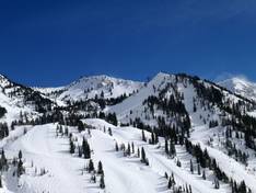
Orientation (Trail map, information boards, sign-postings) and safety in the ski resort Snowbird
Trail map and overview maps
The trail map provides an excellent overview of the Snowbird ski area. The slopes and lifts are clearly marked. The areas Peruvian Gulch and Gad Valley as well as Mineral Basin are shown on two maps. Important points in the ski area are indicated. Further information on dining, the ski school, ski rental, and shops is available.
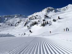
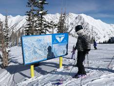
Information boards and sign-postings on the slopes
Numerous information boards with trail maps are set up throughout the ski area. The current opening status is displayed in several locations. The signage is clear. The ski area boundaries and open or closed areas are easy to identify.
Trail map

Snowbird Season 2025/2026
Top Orientation


14 strengths of this ski resort


Feedback for the Skiresort.info Team? Please use this form
Select specific criteria
Top evaluation criteria
Further evaluation criteria
Orientation (trail map, information boards, sign-postings)
Evaluation criteria for special interests
Feedback for the Skiresort.info Team? Please use this form
Book this ski resort
Test Reports

Tips for the ski holiday