Ski resorts Germany
Route planner Todtnauberg
Access Todtnauberg & on-site parking
When coming from the west, you take Autobahn no. 5 until Freiburg Mitte. At Freiburg, after crossing through the city, you drive a short way on the two lane Bundesstrasse 317 before turning off onto a more narrow, curvy country road at Kirchzarten. This road leads up to the Notschrei Pass. The drive from Freiburg takes about 40 minutes. When coming from the east (Wuerttemberg), you take Autobahn no. 81 and exit at Bad Duerrheim. You then follow Bundesstrasse 31 and 317 until you get to Todtnau, where you take a short, steep road up to Todtnauberg. The distance from Stuttgart is about 190 km (a 2 hours drive). From the south (Basel/Loerrach), you take Bundesstrasse 317 to Todtnau. From Basel, the distance is about 60 km (1 hour drive).Access via
- Autobahn A5 Basel-Frankfurt, Freiburg Centre
34 km approx. 38 min » - Autobahn A81 Stuttgart-Constance, Interchange Bad Duerrheim
73 km approx. 61 min » - Autobahn A 98 Basel Dreieck Weil am Rhein- Lörrach, Dreieck Lörrach
45 km approx. 45 min »
Mobility on-site
- No ski buses
- Scheduled buses
- The Regio-Verkehrsverbund Freiburg provides transportation to Todtnauberg on an hourly basis from Freiburg, Kirchzarten and Todtnau. With the Konus Guest Card, which is included at many accommodations, guests can use the scheduled buses in Hochschwarzwald (Upper Black Forest) for free.
Access via Autobahn A5 Basel-Frankfurt, Freiburg Centre
34 km Distance - approx. 38 Minutes driving time
Destination - Rüttestr. 14, 79674 Todtnau, Germany
- Ideal entry for day visitors
- View on Google Maps
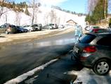
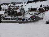
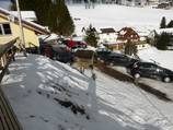
- usually enough available, tarmac car park
- free of charge
- Side road, Mountain road, well-developed, with significant incline
- Snow chains sometimes required by snowfall
- Road closure due to avalanches extremely unlikely
Access via Autobahn A81 Stuttgart-Constance, Interchange Bad Duerrheim
73 km Distance - approx. 61 Minutes driving time
Destination - Rüttestr. 14, 79674 Todtnau, Germany
- Ideal entry for day visitors
- View on Google Maps
- usually enough available, tarmac car park
- free of charge
- Motorway, Highway, Side road, Mountain road, well-developed, with significant incline
- Snow chains never actually required by snowfall
- Road closure due to avalanches extremely unlikely
Access via Autobahn A 98 Basel Dreieck Weil am Rhein- Lörrach, Dreieck Lörrach
45 km Distance - approx. 45 Minutes driving time
Destination - Rüttestr. 14, 79674 Todtnau, Germany
- Ideal entry for day visitors
- View on Google Maps
- usually enough available, tarmac car park
- free of charge
- Side road, Mountain road, well-developed, with significant incline
- Snow chains sometimes required by snowfall
- Road closure due to avalanches extremely unlikely
More Entry point(s) to the ski resort
Destination
- Rüttestr. 16, 79674 Todtnau, Germany
- Entry suitable for day visitors
- View on Google Maps
- limited amount available, tarmac car park
- free of charge
Destination
- Allee 10, 79674 Todtnau, Germany
- View on Google Maps
- limited amount available, tarmac car park
- free of charge
Destination
- Schwimmbadweg, 79674 Todtnau, Germany
- Entry suitable for day visitors
- View on Google Maps
- limited amount available, gravel car park
- free of charge
 Access to ski resort
  Town/village close to ski resort
  Traffic Junction
 All information is supplied without guarantee
The maps are provided by Google with the following information: „These directions are for planning purposes only. You may find that construction projects, traffic, weather, or other events may cause conditions to differ from the map results, and you should plan your route accordingly. You must obey all signs or notices regarding your route.“
Feedback for the Skiresort.info Team? Please use this form »
Book this ski resort
Tips for the ski holiday


