Ski resorts Italy
Route planner Pfelders (Moos in Passeier)
Access Pfelders (Moos in Passeier) & on-site parking
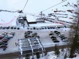
The village of Pfelders is located north of Merano in the Passeier Valley in South Tyrol. From the north, access is via the Brennerautobahn motorway, Sterzing exit. You then continue over the Jaufen Pass. Warning: Check the opening times because this pass is closed at night during the winter. Access from the south is via the Merano-Bolzano expressway. The car park at the base station of the Grünbodenexpress is just before the entrance to the village, next to the slopes. Lift users can get a free card at the parking machines and then register their vehicle number plate at the cash desk. Only residents and hotel guests are permitted to drive on the roads in the village. Winter Closure
The Jaufen Pass is closed from 6 pm until 8 am during the winter season. The Timmelsjoch is closed during the winter.
Access via
- Brenner Autobahn, Exit Sterzing
55 km approx. 74 min » - Schnellstraße Meran-Bozen (MeBo), Ausfahrt Lana
43 km approx. 56 min »
Mobility on-site
- Ski buses
- Scheduled buses
- A scheduled bus runs regularly between Pfelders and Merano. A shuttle bus in the village runs to areas including the practice lift and base station.
Access via Brenner Autobahn, Exit Sterzing
55 km Distance - approx. 74 Minutes driving time
Destination - Pfelders, 39013 Moos in Passeier, Italy
- Ideal entry for day visitors
- View on Google Maps
- usually enough available, tarmac car park, gravel car park
- free of charge
- Side road, Mountain road, Mountain pass road, with significant incline
- Snow chains often required by snowfall
- Road closure due to avalanches sometimes possible
Access via Schnellstraße Meran-Bozen (MeBo), Ausfahrt Lana
43 km Distance - approx. 56 Minutes driving time
Destination - Pfelders, 39013 Moos in Passeier, Italy
- Ideal entry for day visitors
- View on Google Maps
- usually enough available, tarmac car park, gravel car park
- free of charge
- Main street, Mountain road, well-developed, with significant incline
- Snow chains sometimes required by snowfall
- Road closure due to avalanches sometimes possible
 Access to ski resort
  Town/village close to ski resort
  Traffic Junction
 All information is supplied without guarantee
The maps are provided by Google with the following information: „These directions are for planning purposes only. You may find that construction projects, traffic, weather, or other events may cause conditions to differ from the map results, and you should plan your route accordingly. You must obey all signs or notices regarding your route.“
Feedback for the Skiresort.info Team? Please use this form »
Book this ski resort
Tips for the ski holiday


