Orientation (Trail map, information boards, sign-postings) and safety in the ski resort Funäsdalsberget
Trail map and overview maps
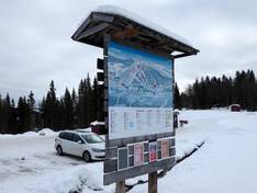
The slope map of the Funäsdalsberget ski area offers a clear and detailed overview of the entire area. All lifts, runs, and important landmarks are clearly marked, making it easy and straightforward to find your way around. On the back of the map, you will also find additional information, such as details about service facilities, infrastructure, and dining options.
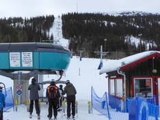
Information boards and sign-postings on the slopes
At key points in the ski area, you will find trail maps displayed. The slopes are usually signposted with names. Current operating information—such as open lifts, weather conditions, or short-term changes—is provided only digitally and can be accessed online.