Orientation (Trail map, information boards, sign-postings) and safety in the ski resort Espace Diamant – Les Saisies/Notre-Dame-de-Bellecombe/Praz sur Arly/Flumet/Crest-Voland
Trail map and overview maps
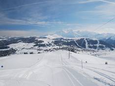
Despite the size of the area and the varying exposures of the slopes, the piste map provides excellent orientation and represents the terrain largely accurately. The pistes are marked with their names, making it easy to determine your current location at any time.
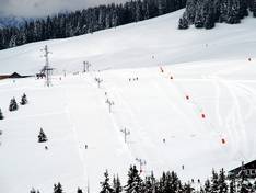
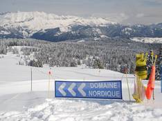
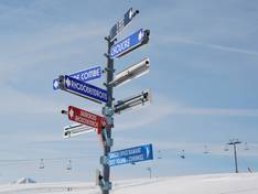
Information boards and sign-postings on the slopes
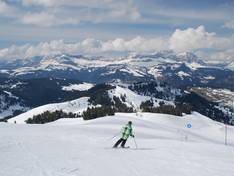
At key points, panoramic boards display the entire area. The marker posts along the slopes indicate not only the level of difficulty but also the slope name and descending numbers. This allows you to estimate the remaining distance at any time. Additionally, signs with directional information to various locations are posted at relevant points, so you can easily find your way without constantly having to pull out the slope map. At the valley stations of the lifts, boards are usually mounted showing the network of slopes served by that lift and providing information about which slopes are open. This makes planning your next run much easier.