Ski resorts Australia

Orientation (Trail map, information boards, sign-postings) Perisher

Evaluated by Skiresort.info, the world's largest test portal for ski resorts.
The evaluation is done as follows
Orientation and safety in the ski resort Perisher
Trail map and overview maps
The piste map provides a very clear overview of the ski resort of Perisher. All lifts and slopes are indicated. Additional detailed maps are available for the individual areas. More altitude indications and details of the base station of the Skitube would be useful. The piste map is only available online, unfortunately there is no longer any printed version.
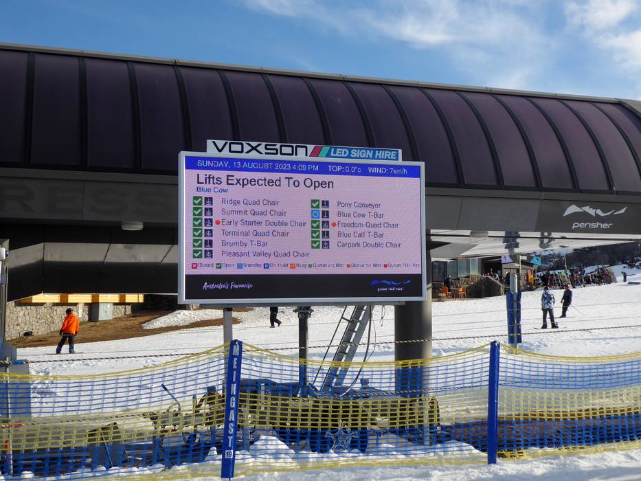
Information boards and sign-postings on the slopes
Exemplary live information about the individual lifts and slopes is provided at important points in the ski areas. In some cases, the waiting times are shown too. The slopes are signposted. Additional signage could be added in some places.
Trail map

Perisher Season 2023

Perisher - Guthega Season 2023

Perisher - Devil's Playground & Double Trouble Season 2023


Feedback for the Skiresort.info Team? Please use this form »
Select specific criteria
Top evaluation criteria
Further evaluation criteria
Orientation (trail map, information boards, sign-postings)
Evaluation criteria for special interests
Feedback for the Skiresort.info Team? Please use this form »
Book this ski resort
Test Reports


Tips for the ski holiday

