Switzerland
  • Grächen
    • Worldwide
    • Europe
    • Switzerland
    • Lemanic Region
    • Valais (Wallis)
    • Matter Valley (Mattertal)
Select region
close
Continents
Countries
Greater Regions
Cantons
Valleys

Directions Grächen

Directions to the ski resort Grächen

Route planner, detailed directions, entry point(s)

Route planner

Access & on-site parking

Access to Grächen by car is possible from four directions:
- Via the Rhone Valley: Martigny-Visp
- Car shuttle Lötschberg: Kandersteg-Goppenstein-Visp
- Car shuttle Furka: Andermatt-Realp-Oberwald-Brig-Visp
- Ticino/Simplon: Lugano-Centovalli-Domodossola-Brig-Visp

From Visp, follow the signs to Zermatt. In St. Niklaus, the sometimes narrow and winding mountain road branches off towards Grächen. The limited parking spaces at the Hannigalpbahn are subject to a fee. The municipal parking garage is located at the entrance to the village.

Route Planner to the ski resort Grächen

Please enter a start address and calculate route:


Access via

Mobility on-site
  • Ski buses
  • Scheduled buses
  • For all guests staying in St. Niklaus, Gasenried, and Niedergrächen, the ski bus (Postauto) is available free of charge to take you to the ski slopes and back.

Access via A8 Spiez-Interlaken, exit Spiez
86 km Distance - approx. 121 Minutes driving time
Destination Parking spaces
  • limited amount available, tarmac car park
  • for a fee
Roads
  • Main street, Side road, Mountain road, partially developed, with significant incline
  • Snow chains often required by snowfall
  • Road closure due to avalanches unlikely
Show route
Access via A2, exit 40 Göschenen
107 km Distance - approx. 133 Minutes driving time
Destination Parking spaces
  • limited amount available, tarmac car park
  • for a fee
Roads
  • Main street, Side road, Mountain road, partially developed, with significant incline
  • Snow chains often required by snowfall
  • Road closure due to avalanches unlikely
Show route
Access via A9 Autoroute du Rhône, end of the motorway at Sierre
50 km Distance - approx. 57 Minutes driving time
Destination Parking spaces
  • limited amount available, tarmac car park
  • for a fee
Roads
  • Main street, Side road, Mountain road, partially developed, with significant incline
  • Snow chains often required by snowfall
  • Road closure due to avalanches unlikely
Show route
Access via E62 Strada del Sempione, Domodossola
99 km Distance - approx. 101 Minutes driving time
Destination Parking spaces
  • limited amount available, tarmac car park
  • for a fee
Roads
  • Main street, Side road, Mountain road, partially developed, with significant incline
  • Snow chains often required by snowfall
Show route
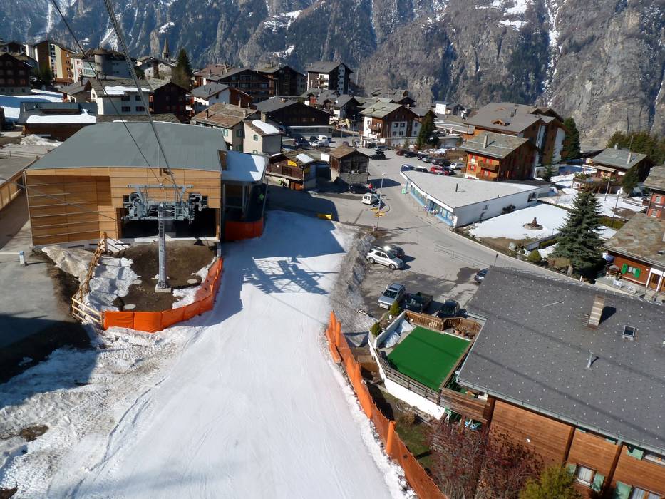
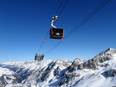
Access to ski resort
Town/village close to ski resort
Traffic Junction

All information is supplied without guarantee
The maps are provided by Google with the following information: „These directions are for planning purposes only. You may find that construction projects, traffic, weather, or other events may cause conditions to differ from the map results, and you should plan your route accordingly. You must obey all signs or notices regarding your route.“


Feedback for the Skiresort.info Team? Please use this form
Tips for the ski holiday