Ski resorts Italy

Route planner Pejo 3000
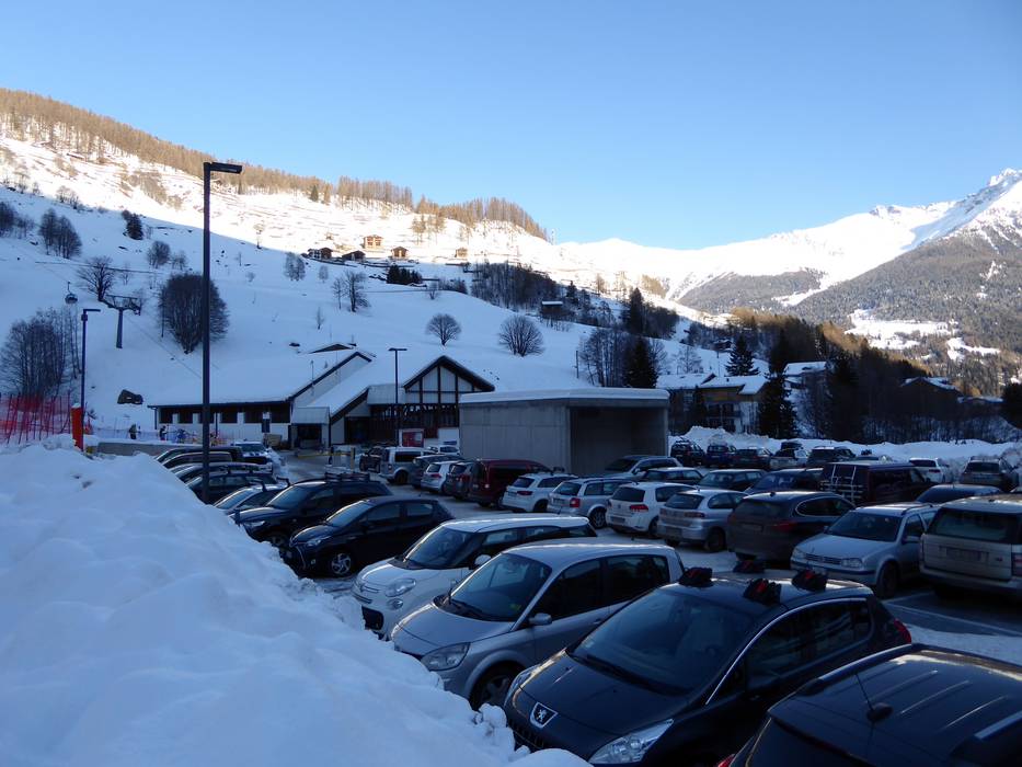
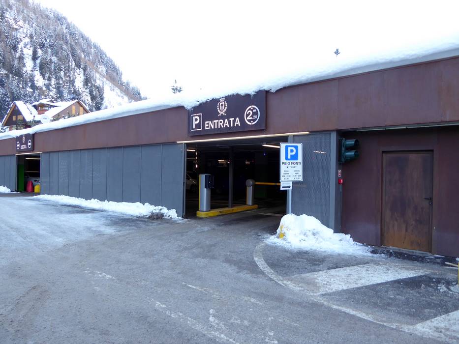
Access Pejo 3000 & on-site parking
The ski resort of Pejo is located in the Val di Pejo (Pejo Valley), a side valley of the Val di Sole. Approaching from the direction of the Brenner Pass (north) or Bologna/Verona, access is via the Brennerautobahn motorway. The resort is around 65 kilometres from the San Michele all'Adige exit. Coming from Bergamo and Brescia, the ski resort is around 130 kilometres from the motorway. Payable parking is available right next to the base station and in the multi-storey car park. Fly Ski Shuttles are available to transport holidaymakers from the airport to the resort.Access via
- Brenner Autobahn, Exit San Michele all'Adige
64 km approx. 75 min » - Autobahn A4 Turin-Triest (Torino-Trieste), Exit Ospitaletto
142 km approx. 151 min » - Strada Statale 36, End of Autobahn Gera Lario
140 km approx. 167 min » - Autobahn A4 Turin-Triest (Torino-Trieste), Ausfahrt Bergamo
151 km approx. 167 min »
Mobility on-site
- Comprehensive ski bus network
- Scheduled buses
- All areas of the Val di Sole are served by ski buses. Several lines run to the individual ski areas and villages.
Access via Brenner Autobahn, Exit San Michele all'Adige
64 km Distance - approx. 75 Minutes driving time
Destination - Via dei Cavai, 38024 Peio, Italy
- Ideal entry for day visitors
- View on Google Maps
- usually enough available, covered car park, tarmac car park, gravel car park
- for a fee
- Mountain road, well-developed

Access via Autobahn A4 Turin-Triest (Torino-Trieste), Exit Ospitaletto
142 km Distance - approx. 151 Minutes driving time
Destination - Via dei Cavai, 38024 Peio, Italy
- Ideal entry for day visitors
- View on Google Maps
- usually enough available, covered car park, tarmac car park, gravel car park
- for a fee
- Mountain road, well-developed
Access via Strada Statale 36, End of Autobahn Gera Lario
140 km Distance - approx. 167 Minutes driving time
Destination - Via dei Cavai, 38024 Peio, Italy
- Ideal entry for day visitors
- View on Google Maps
- usually enough available, covered car park, tarmac car park, gravel car park
- for a fee
- Mountain road, well-developed
Access via Autobahn A4 Turin-Triest (Torino-Trieste), Ausfahrt Bergamo
151 km Distance - approx. 167 Minutes driving time
Destination - Via dei Cavai, 38024 Peio, Italy
- Ideal entry for day visitors
- View on Google Maps
- usually enough available, covered car park, tarmac car park, gravel car park
- for a fee
- Mountain road, well-developed
 Access to ski resort
  Town/village close to ski resort
  Traffic Junction
 All information is supplied without guarantee
The maps are provided by Google with the following information: „These directions are for planning purposes only. You may find that construction projects, traffic, weather, or other events may cause conditions to differ from the map results, and you should plan your route accordingly. You must obey all signs or notices regarding your route.“
Feedback for the Skiresort.info Team? Please use this form »
Book this ski resort

Test Reports

