Ski resorts Austria


Orientation (Trail map, information boards, sign-postings) KitzSki – Kitzbühel/Kirchberg

Evaluated by Skiresort.info, the world's largest test portal for ski resorts.
The evaluation is done as follows
Orientation and safety in the ski resort KitzSki – Kitzbühel/Kirchberg
Trail map and overview maps
The piste map provides a very clear overview of the entire KitzSki ski resort. All slopes can be easily identified and are numbered. The different ski lifts are also numbered for easy identification. The main summits are clearly highlighted including altitude measurements. All restaurants are also listed. Prices and additional information are provided on the reverse of the map.
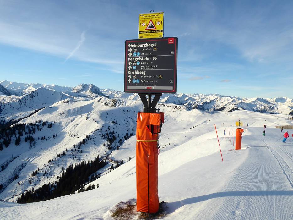
Information boards and sign-postings on the slopes
Signposts guide skiers precisely to their desired location. A consistent and modern slope guidance system was introduced in the 2022/2023 season. Visitor ‘infotainment’ systems (digital banner system) provide information throughout the ski resort. This includes safety information, the latest snow and weather reports, open slopes and orientation assistance. Fluorescent posts along the edges of the runs provide clear orientation in adverse weather. The lifts are clearly and consistently identified with numbers.
Trail map

KitzSki – Kitzbühel/Kirchberg Season 2023/2024


Feedback for the Skiresort.info Team? Please use this form »

Select specific criteria
Top evaluation criteria
Further evaluation criteria
Orientation (trail map, information boards, sign-postings)
Evaluation criteria for special interests
Feedback for the Skiresort.info Team? Please use this form »
Book this ski resort
Test Reports

