Ski resorts Switzerland


Orientation (Trail map, information boards, sign-postings) Grimentz/Zinal

Evaluated by Skiresort.info, the world's largest test portal for ski resorts.
The evaluation is done as follows
Orientation and safety in the ski resort Grimentz/Zinal
Trail map and overview maps
The piste map provides a very clear overview of the ski resort of Grimentz/Zinal and Vercorin. All lifts and slopes are indicated. On the reverse, you can find information and QR codes for the ski buses and restaurants.
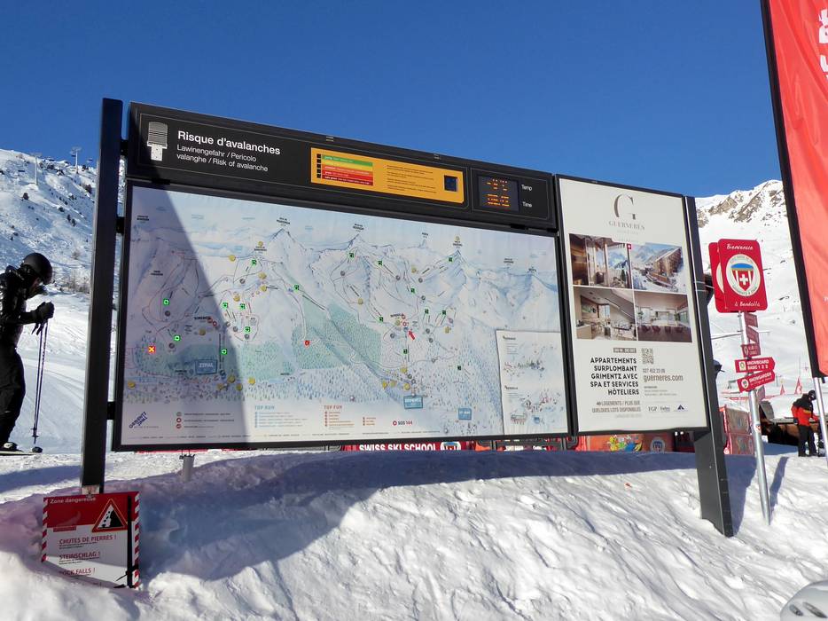
Information boards and sign-postings on the slopes
Detailed information boards showing updated operating information can be found at all important points. All slopes are very well signposted and marked. This makes it very easy to find your way in the high-alpine terrain even in fog.
Trail map

Grimentz/Zinal Season 2023/2024
")
Val d'Anniviers (West/Ouest) Season 2023/2024

Val d'Anniviers Season 2023/2024


Feedback for the Skiresort.info Team? Please use this form »
Select specific criteria
Top evaluation criteria
Further evaluation criteria
Orientation (trail map, information boards, sign-postings)
Evaluation criteria for special interests
Feedback for the Skiresort.info Team? Please use this form »
Book this ski resort
Test Reports
")

Tips for the ski holiday

