Ski resorts Italy

 – Lana")
Orientation (Trail map, information boards, sign-postings) Vigiljoch (Monte San Vigilio) – Lana
Evaluated by Skiresort.info, the world's largest test portal for ski resorts.
The evaluation is done as follows
Orientation and safety in the ski resort Vigiljoch (Monte San Vigilio) – Lana
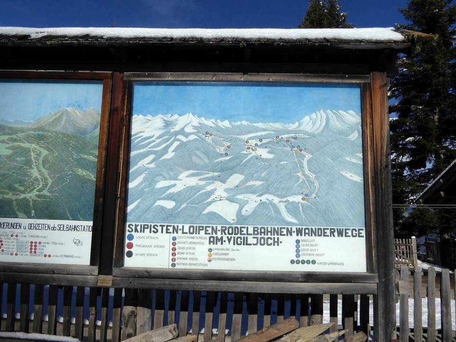
Trail map and overview maps
The trail map depicts all slopes, lifts, toboggan runs and hiking paths on Monte San Vigilio. In some cases, it is difficult to decipher the direction of the slopes and lifts. The Jocher and Seehof pommel lifts meet at the mountain station. There are some hiking recommendations provided for hikers. On the back of the trail map, information about the restaurants and lift schedules is provided.
Information boards and sign-postings on the slopes
There are trail maps showing the ski lifts and slopes at the mountain stations of the cable car lift and the single chairlift. Simple slope markers are used on the slopes. They could provide current operating status information.
Trail map

Vigiljoch Season 2023/2024

Ortler Skiarena Season 2023/2024


Feedback for the Skiresort.info Team? Please use this form »
Select specific criteria
Top evaluation criteria
Further evaluation criteria
Orientation (trail map, information boards, sign-postings)
Evaluation criteria for special interests
Feedback for the Skiresort.info Team? Please use this form »
Book this ski resort
Test Reports
")

Tips for the ski holiday

