Ski resorts Germany


Orientation (Trail map, information boards, sign-postings) Steckenberg – Unterammergau
Evaluated by Skiresort.info, the world's largest test portal for ski resorts.
The evaluation is done as follows
Orientation and safety in the ski resort Steckenberg – Unterammergau
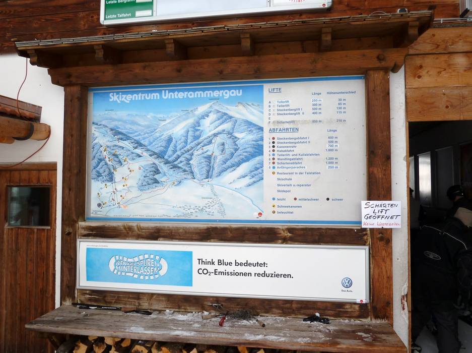
Trail map and overview maps
The trail map depicts the ski resort from an aerial view and all slopes and lifts are indicated. Unfortunately, no elevations or restaurants are included. There are no trail maps in paper format provided.
Information boards and sign-postings on the slopes
There is information about the ski operation and a trail map at the valley station. The connection slopes to the Schachen lift and back are sign-posted. Otherwise there is no information provided on the slopes.
Trail map

Steckenberg – Unterammergau Season 2023/2024


Feedback for the Skiresort.info Team? Please use this form »
Select specific criteria
Top evaluation criteria
Further evaluation criteria
Orientation (trail map, information boards, sign-postings)
Evaluation criteria for special interests
Feedback for the Skiresort.info Team? Please use this form »
Book this ski resort
Test Reports
")

Tips for the ski holiday

