Orientation (Trail map, information boards, sign-postings) and safety in the ski resort Scuol – Motta Naluns
Trail map and overview maps
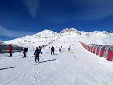
The piste map provides a comprehensive and very clear overview of the ski area, including all altitude information. All lifts, pistes, and facilities such as the snow park, children's area, toboggan run, and restaurants are easy to identify and well described. Only the presence of weather protection covers on the chairlifts could still be added. On the reverse side, you will find prices and the detailed timetables of the Rhaetian Railway and the individual buses.
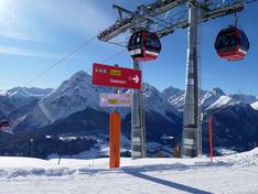
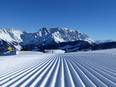
Information boards and sign-postings on the slopes
The signage on the slopes is excellent and you can always find your way around. Panorama boards in the snow sports area, illuminated signs, and a slope guidance system make orientation easier. All slopes are marked on both sides so that even in bad weather it is clear where the slope runs.