Ski resorts Norway


Orientation (Trail map, information boards, sign-postings) Myrkdalen

Evaluated by Skiresort.info, the world's largest test portal for ski resorts.
The evaluation is done as follows
Orientation and safety in the ski resort Myrkdalen
Trail map and overview maps
The trail map depicts the entire ski resort very well. All lifts and slopes are shown with names and descriptions. There is also a handy paper map that you can take with you that shows the trail map in a large format. On the back, the opening times, prices and other information are shown. All brochures are available in Norwegian as well as English.
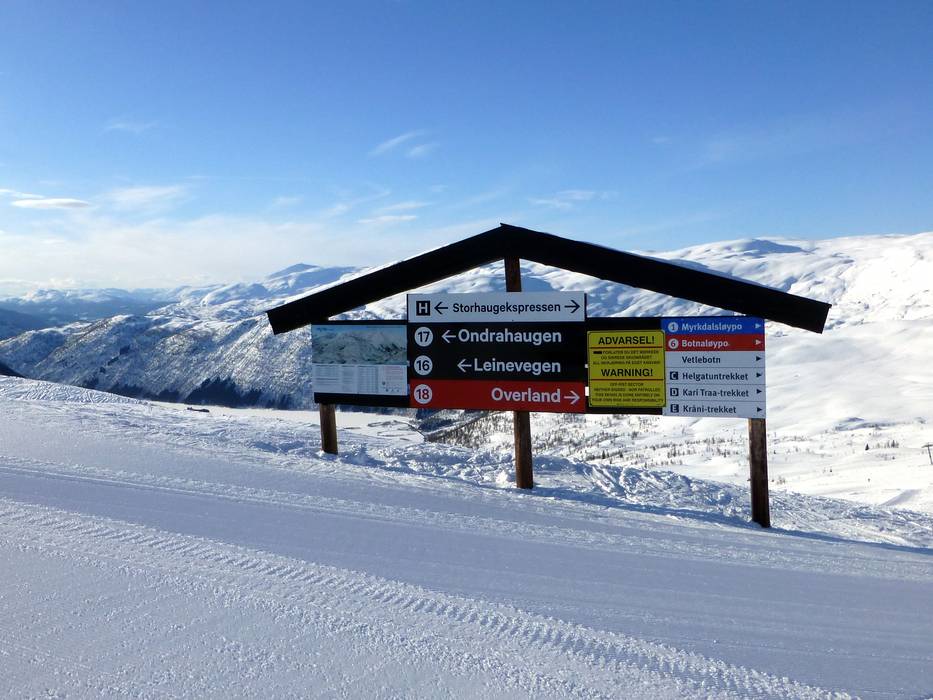
Information boards and sign-postings on the slopes
The slopes are marked well and information and trail maps are available in the ski resort. The slope borders are also marked well and color-coded to indicate the difficulty level of the particular slope.
Trail map

Myrkdalen Mountain Resort Season 2023/2024


Feedback for the Skiresort.info Team? Please use this form »
Select specific criteria
Top evaluation criteria
Further evaluation criteria
Orientation (trail map, information boards, sign-postings)
Evaluation criteria for special interests
Feedback for the Skiresort.info Team? Please use this form »
Book this ski resort
Test Reports


Tips for the ski holiday

