Ski resorts Switzerland


Orientation (Trail map, information boards, sign-postings) Meiringen-Hasliberg

Evaluated by Skiresort.info, the world's largest test portal for ski resorts.
The evaluation is done as follows
Orientation and safety in the ski resort Meiringen-Hasliberg
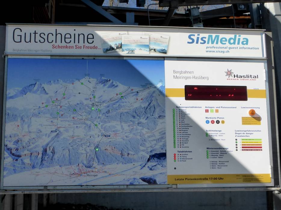
Trail map and overview maps
The trail map is clearly laid out. All slopes and lifts as well as important information are indicated. The names of the mountain restaurants could be added.
Information boards and sign-postings on the slopes
The sign-posting in the ski resort is very good. There are directional signs on all of the slopes. Information boards have been erected at some of the important points, particularly at the gondola lifts, which show the current statuses of the slopes and lifts. The numerous slope markers also provide additional orientation assistance and make it possible to navigate even during bad weather.
Trail map

Meiringen-Hasliberg Season 2023/2024


Feedback for the Skiresort.info Team? Please use this form »

Select specific criteria
Top evaluation criteria
Further evaluation criteria
Orientation (trail map, information boards, sign-postings)
Evaluation criteria for special interests
Feedback for the Skiresort.info Team? Please use this form »
Book this ski resort
Test Reports


Tips for the ski holiday

