
Evaluated by Skiresort.info, the world's largest test portal for ski resorts.
The evaluation is done as follows
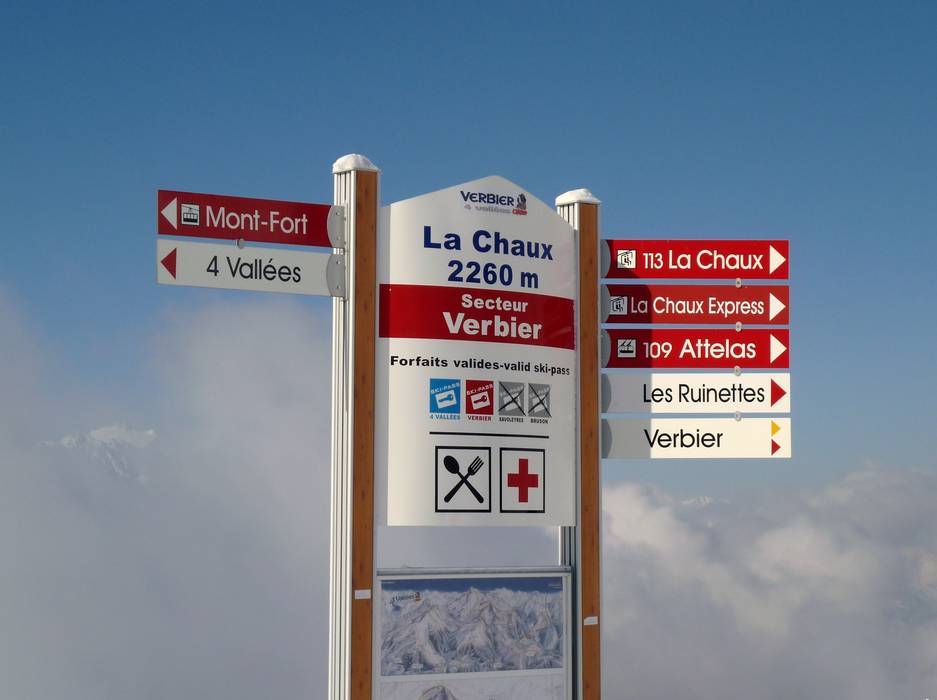
Orientation (Trail map, information boards, sign-postings) and safety in the ski resort 4 Vallées – Verbier/La Tzoumaz/Nendaz/Veysonnaz/Thyon
There are detailed trail maps available at all ticket offices and cable car stations to take with you. The trail map provides an excellent overview of the entire ski area. All slopes, lifts, and altitude information are clearly marked. More information about the mountain huts would be helpful.
There is good signage on the slopes. Signs are posted at all intersections, and at the valley and mountain stations you will also find slope maps with up-to-date information. Important: You should allow enough time for the return journey to the starting point of your ski day, as you may not be able to reach it once the lifts have closed.


Feedback for the Skiresort.info Team? Please use this form