Ski resorts France


Orientation (Trail map, information boards, sign-postings) Les 2 Alpes

Evaluated by Skiresort.info, the world's largest test portal for ski resorts.
The evaluation is done as follows
Orientation and safety in the ski resort Les 2 Alpes
Trail map and overview maps
The trail map is very easy to read. It shows the entire resort as well as a detailed view of the snowpark. Unfortunately, the lift symbols are not very clear and additional information such as the length of the lifts and slopes is missing. There is a legend on the map (including the signs on the slopes) and detailed maps of the complete upper area, the "Station" sector and the "Vallée Blanche" sector. The huts and restaurants are also shown on the detailed maps. Current information about events and the ski bus schedule are also not included.
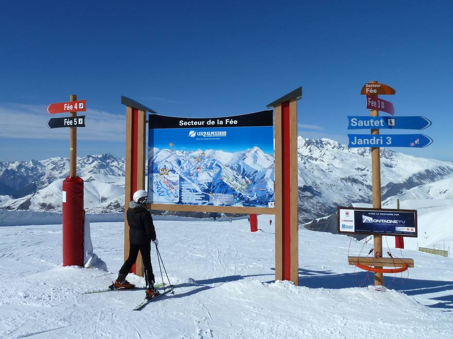
Information boards and sign-postings on the slopes
There are signs at all intersections and turn offs. There are also overview maps at the main intersections. The sectors are marked clearly. At the lifts, the name of the lift, the slopes it accesses, the statuses (open/closed) of these slopes and a sketch are shown. Dangerous spots and special zones such as beginner areas and slow skiing areas are clearly marked.
Trail map

Les 2 Alpes Season 2023/2024


Feedback for the Skiresort.info Team? Please use this form »

Select specific criteria
Top evaluation criteria
Further evaluation criteria
Orientation (trail map, information boards, sign-postings)
Evaluation criteria for special interests
Feedback for the Skiresort.info Team? Please use this form »
Book this ski resort
Test Reports


Tips for the ski holiday

