
Evaluated by Skiresort.info, the world's largest test portal for ski resorts.
The evaluation is done as follows
Orientation (Trail map, information boards, sign-postings) and safety in the ski resort Sonnenkopf – Klösterle
Trail map and overview maps
The trail map is very clearly laid out and provides all the necessary information for a smooth day of skiing. The length of each individual run is also indicated separately. Safety instructions and information about protected areas are also included.
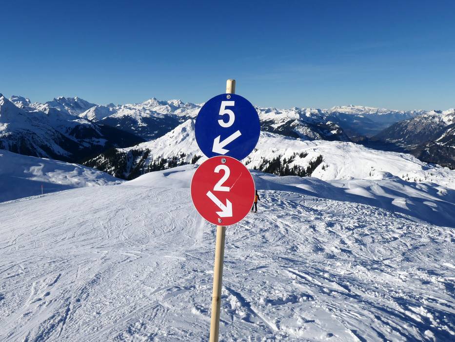
Information boards and sign-postings on the slopes
At key locations in the ski area, slope maps with real-time information on open slopes and lifts are installed. Thanks to excellent signage, smooth orientation is possible even at intersections and junctions. The edges of the slopes are well marked.
Trail map

Sonnenkopf – Klösterle Season 2025/2026
12 strengths of this ski resort


Feedback for the Skiresort.info Team? Please use this form

Select specific criteria
Top evaluation criteria
Further evaluation criteria
Orientation (trail map, information boards, sign-postings)
Evaluation criteria for special interests
Feedback for the Skiresort.info Team? Please use this form