Test result
Evaluated by Skiresort.info, the world's largest test portal for ski resorts.
The evaluation is done as follows
Orientation (Trail map, information boards, sign-postings) and safety in the ski resort Kaunertal Glacier (Kaunertaler Gletscher)
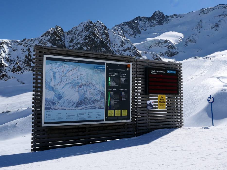
Trail map and overview maps
The piste map shows the Kaunertal Glacier and the Fendels ski area together. In general, the slopes and lifts are well marked, but in some places the map differs from reality. Important highlights are indicated.
Information boards and sign-postings on the slopes
The slopes are very good and marked at close intervals. This makes it easy to find your way around the glacier even in foggy conditions. However, it would be helpful to install additional signs or slope maps at the junctions.
Trail map

Kaunertaler Gletscher Season 2025/2026
Top Orientation


10 strengths of this ski resort


Feedback for the Skiresort.info Team? Please use this form

Select specific criteria
Top evaluation criteria
Further evaluation criteria
Orientation (trail map, information boards, sign-postings)
Evaluation criteria for special interests
Feedback for the Skiresort.info Team? Please use this form
Test Reports
Tips for the ski holiday