Orientation and safety in the ski resort Kaltenbach – Hochzillertal/Hochfügen (SKi-optimal)
Trail map and overview maps
The piste map is exemplary. All lifts and slopes are easy to recognise. The entire ski resort is shown. Restaurants and important points are highlighted. The entire Ziller Valley is shown on the reverse.
Information boards and sign-postings on the slopes
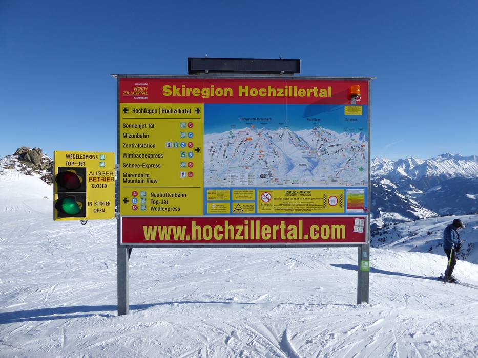
It is very easy to find your way. Signposting is clear and easy to follow, as are the markings on the individual slopes. A traffic light system indicates whether a lift is open or closed.
Trail map
Kaltenbach – Hochzillertal/Hochfügen Season 2023/2024
Information on video walls
Hochzillertal slope signposting
Detailed information at the…
Hochfügen slope signposting
Information board in the ski resort
Information at the entrance to the Wimbachexpress
Hochzillertal slope signposting
Information at the entrance to the Kristallexpress
Slope signposting and piste map
Hochfügen slope signposting
Feedback for the Skiresort.info Team? Please use this form »
Please wait and do not close window. File will be transmitted.