Ski resorts Austria


Route planner Großglockner Resort Kals-Matrei
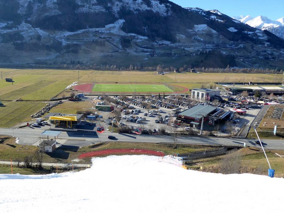
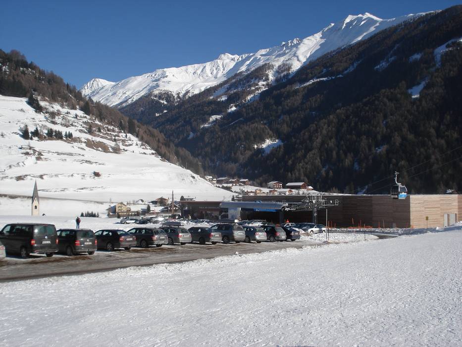
Access Großglockner Resort Kals-Matrei & on-site parking
The entry points to the Großglockner Resort ski area are in Matrei and Kals. Matrei is located directly on the state road between Mittersill and Lienz. Access from the north via Mittersill is from the Felbertauernstrasse road and the Felbertauern Tunnel (toll is charged). Access from the south is via Lienz. From the Mittersill-Lienz state road, a mountain road leads into a side valley to Kals. The nearest motorways are around 100 kilometres from the ski resort. There is sufficient free parking directly at the base stations in Kals and Matrei.Access via
- A12 Inntal Autobahn, Exit Kufstein Sued (South)
101 km approx. 90 min » - Brenner Autobahn, Exit Brixen/Bressanone-Pustertal
127 km approx. 123 min » - A10 Tauern Autobahn, Exit Intersection Pongau
109 km approx. 92 min » - A10 Tauernautobahn, Ausfahrt Lendorf (Knoten Spittal)
89 km approx. 71 min »
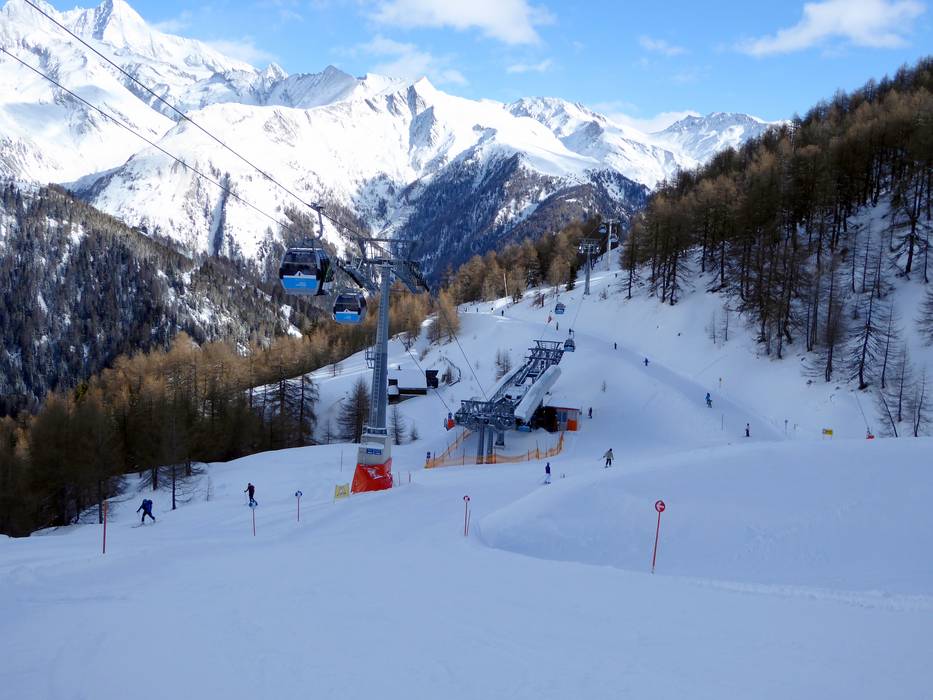
Mobility on-site
- Ski buses
- Scheduled buses
- Ski buses run every 15 minutes in the morning and afternoon from Matrei to the gondola lift and back.
Access via A12 Inntal Autobahn, Exit Kufstein Sued (South)
101 km Distance - approx. 90 Minutes driving time
Destination - Europa Straße 5, 9971 Matrei in Osttirol, Austria
- Ideal entry for day visitors
- View on Google Maps
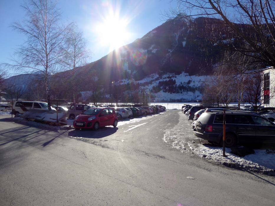
- enough available, tarmac car park, gravel car park
- free of charge
- Main street, Side road, Mountain road, well-developed, with significant incline
- Snow chains sometimes required by snowfall
- Road closure due to avalanches sometimes possible

121 km Distance - approx. 112 Minutes driving time
Destination - Großdorf, 9981 Kals am Großglockner, Austria
- Ideal entry for day visitors
- View on Google Maps
- limited amount available, tarmac car park, gravel car park
- free of charge
- Main street, Side road, Mountain road, well-developed
- Snow chains sometimes required by snowfall
- Road closure due to avalanches sometimes possible

121 km Distance - approx. 113 Minutes driving time
Destination - Großdorf 70, 9981 Kals am Großglockner, Austria
- Entry suitable for day visitors
- View on Google Maps
- limited amount available, tarmac car park, gravel car park
- free of charge
- Main street, Side road, Mountain road, Mountain pass road, well-developed, with significant incline
- Snow chains sometimes required by snowfall
- Road closure due to avalanches sometimes possible

Access via Brenner Autobahn, Exit Brixen/Bressanone-Pustertal
127 km Distance - approx. 123 Minutes driving time
Destination - Europa Straße 5, 9971 Matrei in Osttirol, Austria
- Ideal entry for day visitors
- View on Google Maps
- enough available, tarmac car park, gravel car park
- free of charge
- Main street, Side road, well-developed
- Snow chains sometimes required by snowfall
- Road closure due to avalanches unlikely
132 km Distance - approx. 133 Minutes driving time
Destination - Großdorf, 9981 Kals am Großglockner, Austria
- Ideal entry for day visitors
- View on Google Maps
- limited amount available, tarmac car park, gravel car park
- free of charge
- Main street, Side road, Mountain road, well-developed
- Snow chains sometimes required by snowfall
- Road closure due to avalanches unlikely
133 km Distance - approx. 135 Minutes driving time
Destination - Großdorf 70, 9981 Kals am Großglockner, Austria
- Entry suitable for day visitors
- View on Google Maps
- limited amount available, tarmac car park, gravel car park
- free of charge
- Main street, Side road, Mountain road, well-developed, with significant incline
- Snow chains sometimes required by snowfall
- Road closure due to avalanches unlikely
Access via A10 Tauern Autobahn, Exit Intersection Pongau
109 km Distance - approx. 92 Minutes driving time
Destination - Europa Straße 5, 9971 Matrei in Osttirol, Austria
- Ideal entry for day visitors
- View on Google Maps
- enough available, tarmac car park, gravel car park
- free of charge
- Main street, Side road, well-developed
- Snow chains almost never required by snowfall
- Road closure due to avalanches unlikely
130 km Distance - approx. 114 Minutes driving time
Destination - Großdorf, 9981 Kals am Großglockner, Austria
- Ideal entry for day visitors
- View on Google Maps
- limited amount available, tarmac car park, gravel car park
- free of charge
- Main street, Side road, Mountain road, well-developed, with significant incline
- Snow chains sometimes required by snowfall
- Road closure due to avalanches sometimes possible
130 km Distance - approx. 115 Minutes driving time
Destination - Großdorf 70, 9981 Kals am Großglockner, Austria
- Entry suitable for day visitors
- View on Google Maps
- limited amount available, tarmac car park, gravel car park
- free of charge
- Main street, Side road, Mountain road, well-developed, with significant incline
- Snow chains sometimes required by snowfall
- Road closure due to avalanches unlikely
Access via A10 Tauernautobahn, Ausfahrt Lendorf (Knoten Spittal)
89 km Distance - approx. 71 Minutes driving time
Destination - Europa Straße 5, 9971 Matrei in Osttirol, Austria
- Ideal entry for day visitors
- View on Google Maps
- enough available, tarmac car park, gravel car park
- free of charge
- Main street, Side road, well-developed
- Snow chains almost never required by snowfall
- Road closure due to avalanches unlikely
95 km Distance - approx. 82 Minutes driving time
Destination - Großdorf, 9981 Kals am Großglockner, Austria
- Ideal entry for day visitors
- View on Google Maps
- limited amount available, tarmac car park, gravel car park
- free of charge
- Main street, Side road, Mountain road, well-developed, with significant incline
- Snow chains sometimes required by snowfall
- Road closure due to avalanches sometimes possible
96 km Distance - approx. 83 Minutes driving time
Destination - Großdorf 70, 9981 Kals am Großglockner, Austria
- Entry suitable for day visitors
- View on Google Maps
- limited amount available, tarmac car park, gravel car park
- free of charge
- Main street, Side road, Mountain road, well-developed, with significant incline
- Snow chains sometimes required by snowfall
- Road closure due to avalanches unlikely
 Access to ski resort
  Town/village close to ski resort
  Traffic Junction
 All information is supplied without guarantee
The maps are provided by Google with the following information: „These directions are for planning purposes only. You may find that construction projects, traffic, weather, or other events may cause conditions to differ from the map results, and you should plan your route accordingly. You must obey all signs or notices regarding your route.“
Feedback for the Skiresort.info Team? Please use this form »
Book this ski resort

