Ski resorts Austria


Orientation (Trail map, information boards, sign-postings) Grossglockner Heiligenblut

Evaluated by Skiresort.info, the world's largest test portal for ski resorts.
The evaluation is done as follows
Orientation and safety in the ski resort Grossglockner Heiligenblut
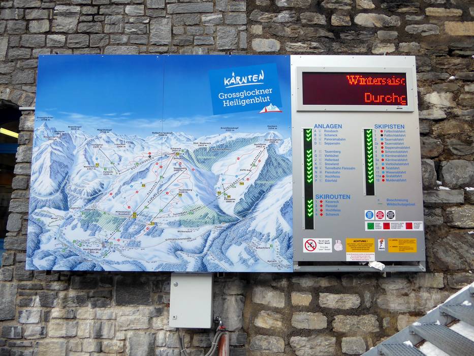
Trail map and overview maps
The trail map depicts the ski resort very well. The slopes, ski routes and lifts are all indicated with names and the many elevation indications make orientation easier.
Information boards and sign-postings on the slopes
Large information boards with current information are found at the most significant points in the ski resort. The sign-posting on the slopes is good. There is a Freeride Checkpoint at the Rossbach middle station.
Trail map

Grossglockner Heiligenblut Season 2023/2024


Feedback for the Skiresort.info Team? Please use this form »
Select specific criteria
Top evaluation criteria
Further evaluation criteria
Orientation (trail map, information boards, sign-postings)
Evaluation criteria for special interests
Feedback for the Skiresort.info Team? Please use this form »
Book this ski resort
Test Reports


Tips for the ski holiday

