Orientation and safety in the ski resort Gitschberg Jochtal
Trail map and overview maps
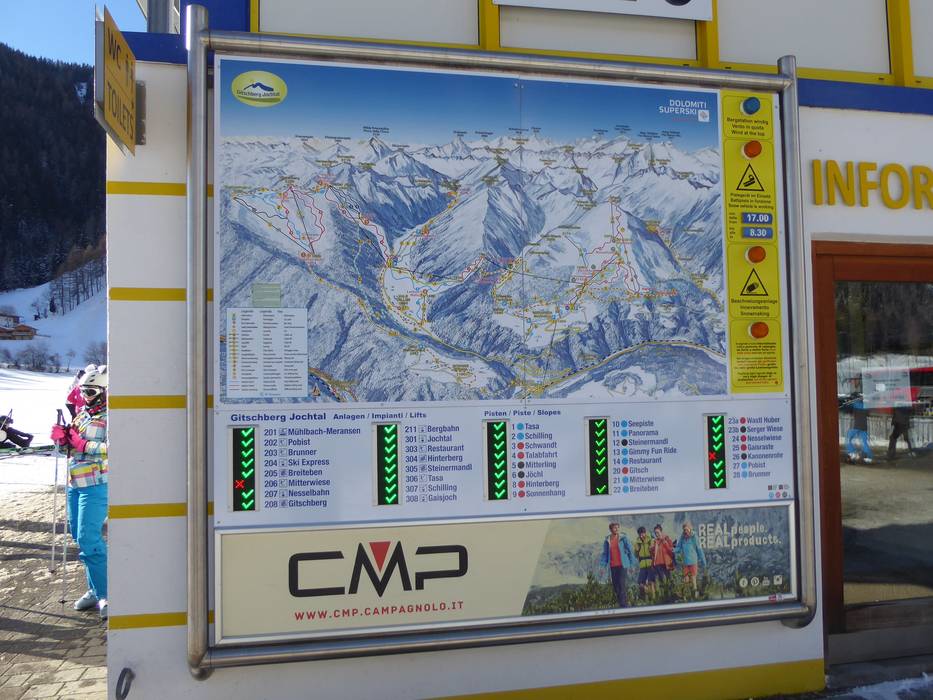
The piste map gives a clear overview of the ski resort of Gitschberg Jochtal. It shows all lifts, slopes and ski huts. On the reverse, you can find the weekly programme, prices and details of other activities. Piste maps and ski bus timetables are available in all ski pass offices.
Information boards and sign-postings on the slopes
There are lots of information boards and signposts in the ski resort. The current operating status of the individual lifts is displayed at the base stations. Even more signposting would be useful in some places.
Trail map
Gitschberg-Jochtal Season 2023/2024
Signposting in the ski resort
Information board in the ski resort
Feedback for the Skiresort.info Team? Please use this form »
Please wait and do not close window. File will be transmitted.