Ski resorts Germany

Orientation (Trail map, information boards, sign-postings) Brauneck – Lenggries/Wegscheid

Evaluated by Skiresort.info, the world's largest test portal for ski resorts.
The evaluation is done as follows
Orientation and safety in the ski resort Brauneck – Lenggries/Wegscheid
Trail map and overview maps
The piste map provides a very good description of all lifts and slopes. Contact details, ski schools, mountain restaurants, alpine huts and other information are included in the foldable map.
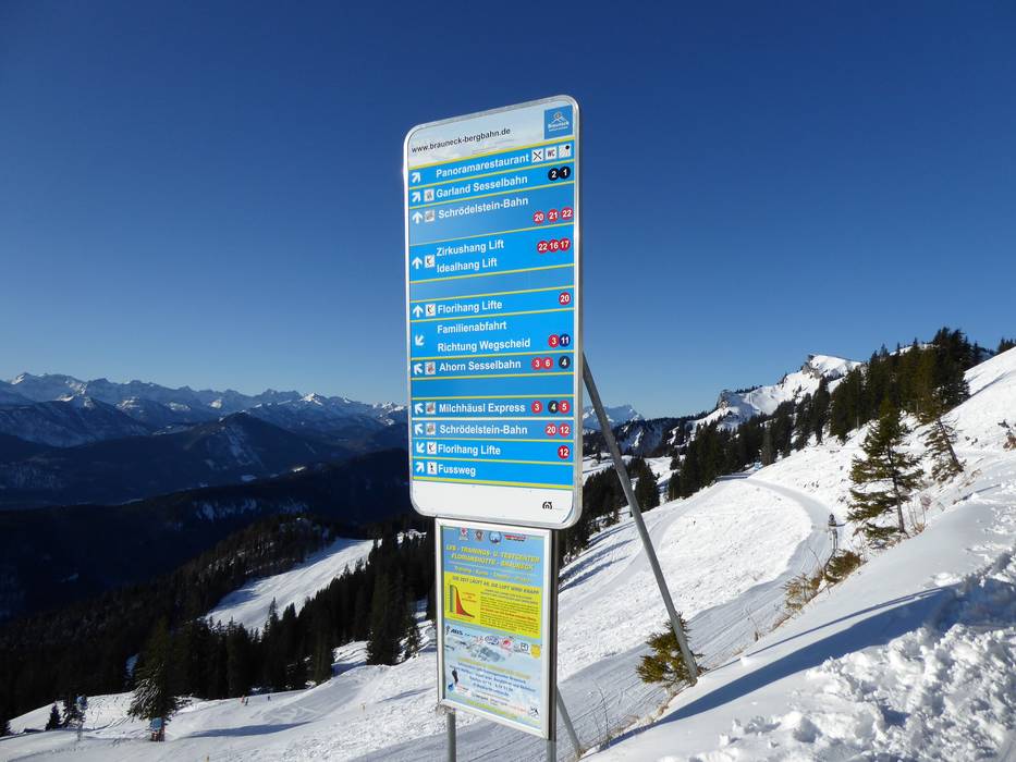
Information boards and sign-postings on the slopes
Piste maps and information about open slopes and lifts can be found at all significant points in the ski resort. The slopes are all clearly signposted.
Trail map

Brauneck – Lenggries/Wegscheid Season 2023/2024


Feedback for the Skiresort.info Team? Please use this form »

Select specific criteria
Top evaluation criteria
Further evaluation criteria
Orientation (trail map, information boards, sign-postings)
Evaluation criteria for special interests
Feedback for the Skiresort.info Team? Please use this form »
Book this ski resort
Test Reports


Tips for the ski holiday

