Ski resorts Italy
Route planner Alagna Valsesia/Gressoney-La-Trinité/Champoluc/Frachey (Monterosa Ski)
Access Alagna Valsesia/Gressoney-La-Trinité/Champoluc/Frachey (Monterosa Ski) & on-site parking
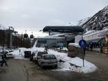
The Champoluc base station is only 30 km from the Autostrada exit in Valle d'Aosta. From the large parking lot at the edge of the village, it's about a 300 m walk to the base station in the middle of the homes in Champoluc. In Val di Gressoney, there is a fee for parking directly at the base station, but not if you park on the other side of the river (connected by a pedestrian bridge). The drive from the Autostrada to Stafal takes about 45 minutes. It's a bit longer from the Autostrada via a narrow road to Alagna. There is no space for a parking lot in the medieval village, so you have to walk a bit from the parking lot to the lift.Access via
- Autobahn A 26 Genova- Gravellona Ausfahrt Romagno-Sesia-Gemme
69 km approx. 82 min » - Autobahn A5 Turin-Aosta, Ausfahrt Verrès
29 km approx. 40 min » - Autobahn A5 Turin-Aosta, Ausfahrt Pont Saint Martin
35 km approx. 47 min »
Mobility on-site
- Ski buses
- Scheduled buses
- Ski buses run in Val di Gressoney and in Val d'Ayas from Christmas until April. There are also direct bus connections from the airports in Turin, Milan and Geneva.
Access via Autobahn A 26 Genova- Gravellona Ausfahrt Romagno-Sesia-Gemme
69 km Distance - approx. 82 Minutes driving time
Destination - Frazione Bonda, 13021 Alagna Valsesia, Italy
- Ideal entry for day visitors
- View on Google Maps
- limited amount available, tarmac car park, gravel car park
- free of charge
- Side road, not developed
- Snow chains never actually required by snowfall
- Road closure due to avalanches extremely unlikely
Access via Autobahn A5 Turin-Aosta, Ausfahrt Verrès
29 km Distance - approx. 40 Minutes driving time
Destination - Stada Statale 506, 11020 Ayas, Italy
- Ideal entry for day visitors
- View on Google Maps
- enough available, tarmac car park
- free of charge
- Side road, Mountain road, partially developed
- Snow chains sometimes required by snowfall
- No chance of road closure due to avalanches
30 km Distance - approx. 41 Minutes driving time
Destination - Strada Regionale 45, 11020 Frachey, Italy
- View on Google Maps
- usually enough available, tarmac car park
- free of charge
- Side road, Mountain road, partially developed
- Snow chains sometimes required by snowfall
- No chance of road closure due to avalanches
Access via Autobahn A5 Turin-Aosta, Ausfahrt Pont Saint Martin
35 km Distance - approx. 47 Minutes driving time
Destination - Loc. Underwoald, 33a, 11020 Gressoney-La-Trinité, Italy
- Ideal entry for day visitors
- View on Google Maps
- enough available, tarmac car park
- free of charge
- Side road, Mountain road, partially developed
- Snow chains sometimes required by snowfall
- Road closure due to avalanches extremely unlikely
39 km Distance - approx. 52 Minutes driving time
Destination - Località Gressoney Monte Rosa, 33, 11020 Gressoney-la-Trinité, Italy
- Ideal entry for day visitors
- View on Google Maps
- enough available, tarmac car park
- for a fee, € 4,- / per day
- Side road, Mountain road, partially developed
- Snow chains sometimes required by snowfall
- Road closure due to avalanches extremely unlikely
 Access to ski resort
  Town/village close to ski resort
  Traffic Junction
 All information is supplied without guarantee
The maps are provided by Google with the following information: „These directions are for planning purposes only. You may find that construction projects, traffic, weather, or other events may cause conditions to differ from the map results, and you should plan your route accordingly. You must obey all signs or notices regarding your route.“
Feedback for the Skiresort.info Team? Please use this form »
Book this ski resort
Tips for the ski holiday


