Ski resorts Switzerland

Orientation (Trail map, information boards, sign-postings) Adelboden/Lenk – Chuenisbärgli/Silleren/Hahnenmoos/Metsch

Evaluated by Skiresort.info, the world's largest test portal for ski resorts.
The evaluation is done as follows
Orientation and safety in the ski resort Adelboden/Lenk – Chuenisbärgli/Silleren/Hahnenmoos/Metsch
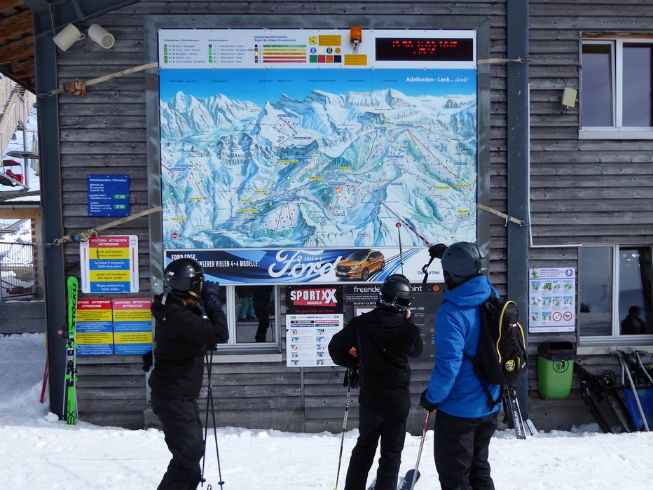
Trail map and overview maps
The trail map depicts all ski resorts of the Adelboden-Lenk ski region well. All lifts, slopes, important information and elevations are included. On the back, prices, contact information, information about winter hiking, tobogganing and cross-country skiing are included.
Information boards and sign-postings on the slopes
The information and signpostings on the slopes are excellent. All slopes are carefully marked and therefore, it is even possible to find your way in the fog. There are large trail maps with current operating statuses at all important lift stations.
Trail map

Adelboden/Lenk Season 2023/2024


Feedback for the Skiresort.info Team? Please use this form »

Select specific criteria
Top evaluation criteria
Further evaluation criteria
Orientation (trail map, information boards, sign-postings)
Evaluation criteria for special interests
Feedback for the Skiresort.info Team? Please use this form »
Book this ski resort
Test Reports

/Malga Calice (Kalcheralm)")
Tips for the ski holiday

