Ski resorts Switzerland


Route planner 4 Vallées – Verbier/La Tzoumaz/Nendaz/Veysonnaz/Thyon
Access 4 Vallées – Verbier/La Tzoumaz/Nendaz/Veysonnaz/Thyon & on-site parking
The holiday villages of Les Quatre Vallées can be easily accessed from the Autobahn through the Rhone Valley. It is best to drive to Le Châble and then to take the gondola lift up to the ski resort. Le Châble is easy to access from the Autobahn and you can park there for free. The other holiday villages are also easily accessible from the Autobahn, but you must take a mountain road up the villages. The parking lots are free except those in Nendaz and in Thyon located directly at the slopes. Winter Closure
The Grand St. Bernard Pass is closed from October until May. You can only travel through the tunnel from Italy then.
Access via
- A9 Autoroute du Rhône, Exit Martigny-Croix
15 km approx. 15 min » - Autobahn A5 Turin-Aosta (Torino-Aosta), Exit Aosta Est
70 km approx. 59 min » - A9 Autoroute du Rhône, Exit Vétroz
14 km approx. 22 min » - A9 Autoroute du Rhône, Exit Sion-est
20 km approx. 32 min » - A9 Autoroute du Rhône, Exit Sion-ouest
14 km approx. 22 min » - A9 Autoroute du Rhône, Exit Riddes
14 km approx. 23 min »
Mobility on-site
- Ski buses
- Scheduled buses
- There are free ski buses providing a seamless transportation network in the holiday villages of Verbier, La Tzoumaz, Veysonnaz, Thyon and Nendaz.
Access via A9 Autoroute du Rhône, Exit Martigny-Croix
15 km Distance - approx. 14 Minutes driving time
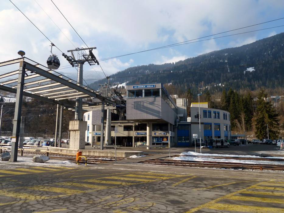
Destination - Place Curala 5 Le Châble, 1934 Bagnes, Switzerland
- View on Google Maps
- Main street, well-developed, without significant incline
- Snow chains almost never required by snowfall
- Road closure due to avalanches extremely unlikely
15 km Distance - approx. 15 Minutes driving time
Destination - Place Curala 5, 1934 Bagnes, Switzerland
- Ideal entry for day visitors
- View on Google Maps
- enough available, gravel car park
- free of charge
- Main street, well-developed, without significant incline
- Snow chains almost never required by snowfall
- Road closure due to avalanches extremely unlikely

24 km Distance - approx. 30 Minutes driving time
Destination - Rue de Médran 41, 1936 Verbier, Switzerland
- View on Google Maps
- none
- Main street, Side road, Mountain road, with significant incline
- Snow chains sometimes required by snowfall
- Road closure due to avalanches sometimes possible
Access via Autobahn A5 Turin-Aosta (Torino-Aosta), Exit Aosta Est
70 km Distance - approx. 59 Minutes driving time
Destination - Place Curala 5, 1934 Bagnes, Switzerland
- Ideal entry for day visitors
- View on Google Maps
- enough available, gravel car park
- free of charge
- Main street, Side road, Mountain road, well-developed, with significant incline
- Snow chains sometimes required by snowfall
- Road closure due to avalanches unlikely
70 km Distance - approx. 67 Minutes driving time
Destination - Place Curala 5 Le Châble, 1934 Bagnes, Switzerland
- View on Google Maps
- Main street, Side road, Mountain road, well-developed, with significant incline
- Snow chains sometimes required by snowfall
- Road closure due to avalanches unlikely
Access via A9 Autoroute du Rhône, Exit Vétroz
14 km Distance - approx. 22 Minutes driving time
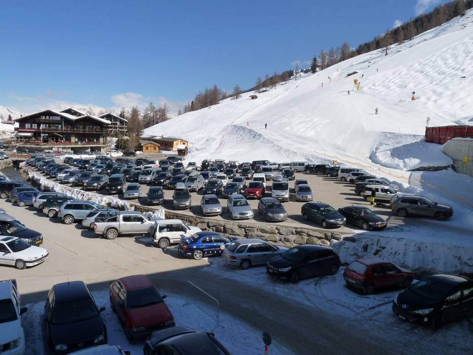
Destination - Route de la Télécabine 61, 1997 Nendaz, Switzerland
- Ideal entry for day visitors
- View on Google Maps
- usually enough available, tarmac car park
- for a fee
- Main street, Mountain road, with significant incline
- Snow chains sometimes required by snowfall
- Road closure due to avalanches unlikely
19 km Distance - approx. 29 Minutes driving time
Destination - Siviez, 1997 Siviez (Nendaz), Switzerland
- Entry suitable for day visitors
- View on Google Maps
- enough available, tarmac car park, gravel car park
- free of charge
- Main street, Side road, Mountain road, with significant incline
- Snow chains sometimes required by snowfall
- Road closure due to avalanches sometimes possible
")
Access via A9 Autoroute du Rhône, Exit Sion-est
20 km Distance - approx. 32 Minutes driving time
Destination - Rue de la Mura, 1988 Les Collons, Switzerland
- Entry suitable for day visitors
- View on Google Maps
- usually enough available, tarmac car park, gravel car park
- for a fee
- Side road, Mountain road, with significant incline
- Snow chains often required by snowfall
- Road closure due to avalanches unlikely

Access via A9 Autoroute du Rhône, Exit Sion-ouest
14 km Distance - approx. 22 Minutes driving time
Destination - Magrappé 56, 1993 Veysonnaz, Switzerland
- Entry suitable for day visitors
- View on Google Maps
- limited amount available, gravel car park
- for a fee
- Main street, Side road, Mountain road, with significant incline
- Snow chains often required by snowfall
- Road closure due to avalanches unlikely
Access via A9 Autoroute du Rhône, Exit Riddes
14 km Distance - approx. 23 Minutes driving time
Destination - Route des Mayens, 1918 Riddes, Switzerland
- Entry suitable for day visitors
- View on Google Maps
- limited amount available, gravel car park
- for a fee
- Main street, Side road, Mountain road, with significant incline
- Snow chains sometimes required by snowfall
- Road closure due to avalanches unlikely
More Entry point(s) to the ski resort
Destination
- Chemin des Luis, 1936 Bagnes, Switzerland
- View on Google Maps
Destination
- Route des Masses, 1987 Hérémence, Switzerland
- View on Google Maps
Destination
- Route de Thyon, 1988 Thyon, Switzerland
- View on Google Maps
Destination
- Route des Zeffeuges, 1992 Les Mayens-de-Sion, Switzerland
- View on Google Maps
 Access to ski resort
  Town/village close to ski resort
  Traffic Junction
 All information is supplied without guarantee
The maps are provided by Google with the following information: „These directions are for planning purposes only. You may find that construction projects, traffic, weather, or other events may cause conditions to differ from the map results, and you should plan your route accordingly. You must obey all signs or notices regarding your route.“
Feedback for the Skiresort.info Team? Please use this form »
Book this ski resort

Tips for the ski holiday
Test Reports


